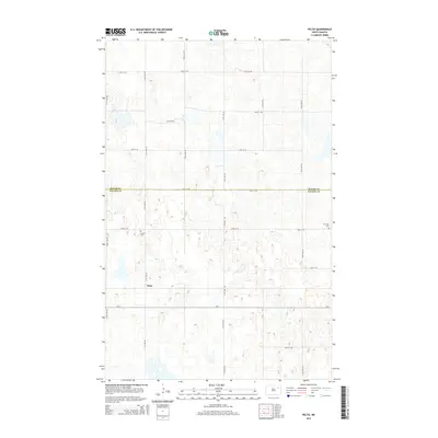
2014 Map of Pelto
USGS Topo · Published 2014About this map
Pelto serves as the central point of interest in this 2014 survey, which covers a largely agricultural portion of the North Dakota plains. The map illustrates a landscape defined by the rigid grid of the Public Land Survey System, with numerous section-line roads such as 112th Ave NE and 54th St NE providing access to the isolated farmsteads and fields. Notable for genealogical research, the area includes the Finnish Cem and W Forest Cem, which anchor the local history of settlement and community life in this region. The northern portion of the map is bisected by the boundary between Walsh Co and Nelson Co, marking a significant administrative divide in the rural countryside. Small, scattered water bodies and wetlands break the geometric regularity of the roads, particularly near the settlement of Pelto.
Find a feature on this map
20 named features on this map. Tap any name to fly to it.
Don’t see what you’re looking for? This feature index may not catch every label — zoom into the map to look around manually.
Map Details
Editions of this 2014 Pelto Map
This is the sole edition of this map. No revisions or reprints were ever made.
Other maps of this area

1953 · Devils Lake
USGS Topo · 1:250,000

1956 · Devils Lake
USGS Topo · 1:250,000

1970 · Lakota
USGS Topo · 1:24,000

1971 · Michigan West
USGS Topo · 1:24,000
1971 · Michigan East
USGS Topo · 1:24,000

1971 · Whitman
USGS Topo · 1:24,000

1971 · Brocket
USGS Topo · 1:24,000

1971 · Pelto
USGS Topo · 1:24,000

1972 · Adams SW
USGS Topo · 1:24,000

1972 · Lawton
USGS Topo · 1:24,000