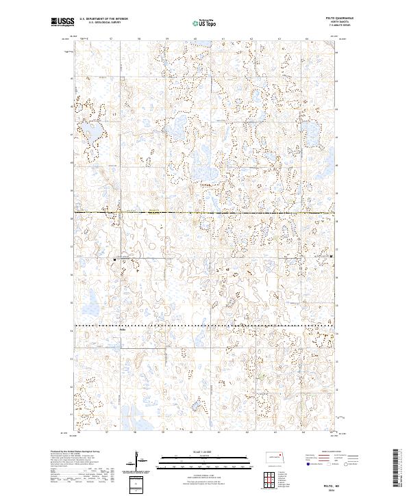
2024 Map of Pelto
USGS Topo · Published 2024About this map
The northern reaches of Nelson Co and the southern edge of Walsh Co converge in this prairie landscape, defined by a dense network of wetlands and small water bodies characteristic of the Red River Valley hinterlands. At the center of this rural topography is Pelto, a settlement served by a grid of county roads that navigate the complex patchwork of marshes and ponds. The map provides a clear record of local pioneer heritage through the presence of several burial grounds, including the Finnish Lutheran Cem Finnish Cem and the West Forest Cem to the east. These sites, along with the Walsh County Waterfowl Production Area, indicate a region where agricultural land use is carefully balanced with conservation and the preservation of early community footprints. The distribution of homesteads and section lines reveals a late-modern stage of the township-and-range system, where the landscape remains largely dedicated to farming and habitat.
Find a feature on this map
25 named features on this map. Tap any name to fly to it.
Don’t see what you’re looking for? This feature index may not catch every label — zoom into the map to look around manually.
Map Details
Editions of this 2024 Pelto Map
This is the sole edition of this map. No revisions or reprints were ever made.
Other maps of this area

1953 · Devils Lake
USGS Topo · 1:250,000

1956 · Devils Lake
USGS Topo · 1:250,000

1970 · Lakota
USGS Topo · 1:24,000

1971 · Michigan West
USGS Topo · 1:24,000
1971 · Michigan East
USGS Topo · 1:24,000

1971 · Whitman
USGS Topo · 1:24,000

1971 · Brocket
USGS Topo · 1:24,000

1971 · Pelto
USGS Topo · 1:24,000

1972 · Adams SW
USGS Topo · 1:24,000

1972 · Lawton
USGS Topo · 1:24,000