
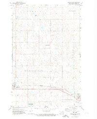
1971 Map of Pelto
USGS Topo · Published 1974About this map
Pelto is a focal point of this rural prairie landscape, positioned along the Soo Line railroad during the early 1970s. The geography is defined by a heavy concentration of glacial wetlands and depressions, characteristic of the Drift Prairie, including a protected National Waterfowl Production Area. Local governance and community heritage are anchored by a rural Townhall and distinct burial grounds such as the Finnish Cem and West Forest Cem. The map highlights the township divisions of Enterprise, Sarnia, Sauter, and Perth, illustrating the late-century transition across the Walsh Co Nelson Co border. Small-scale resource extraction is evident through scattered Gravel Pits, which dot the terrain between the region's agricultural sections.
Find a feature on this map
13 named features on this map. Tap any name to fly to it.
Don’t see what you’re looking for? This feature index may not catch every label — zoom into the map to look around manually.
Map Details
Editions of this 1971 Pelto Map
This is the sole edition of this map. No revisions or reprints were ever made.
Other maps of this area

1953 · Devils Lake
USGS Topo · 1:250,000

1956 · Devils Lake
USGS Topo · 1:250,000

1970 · Lakota
USGS Topo · 1:24,000

1971 · Michigan West
USGS Topo · 1:24,000
1971 · Michigan East
USGS Topo · 1:24,000

1971 · Whitman
USGS Topo · 1:24,000

1971 · Brocket
USGS Topo · 1:24,000

1972 · Adams SW
USGS Topo · 1:24,000

1972 · Lawton
USGS Topo · 1:24,000
1972 · Adams SE
USGS Topo · 1:24,000