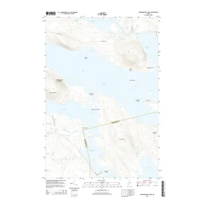
2014 Map of Pemadumcook Lake
USGS Topo · Published 2014About this map
The West Branch Penobscot River flows through this expansive lake system, connecting a series of interconnected water bodies including Passamagamet Lake, Ambejejus Lake, and Pemadumcook Lake. The landscape is defined by its massive water frontage and significant topographic features such as Potaywadjo Ridge and Lincoln Ridge, which rise sharply from the forested shores. A notable intersection of recreation and utility is evident at Stephensons Landing, providing access to these waters near the boundary between Piscataquis and Penobscot counties.
Find a feature on this map
39 named features on this map. Tap any name to fly to it.
Don’t see what you’re looking for? This feature index may not catch every label — zoom into the map to look around manually.
Map Details
Editions of this 2014 Pemadumcook Lake Map
This is the sole edition of this map. No revisions or reprints were ever made.
Other maps of this area

1927 · Katahdin
USGS Topo · 1:48,000

1930 · Katahdin
USGS Topo · 1:62,500

1949 · Katahdin
USGS Topo · 1:62,500

1951 · Norcross
USGS Topo · 1:62,500

1952 · Jo-Mary Mountain
USGS Topo · 1:62,500

1954 · Harrington Lake
USGS Topo · 1:62,500

1954 · Millinocket
USGS Topo · 1:250,000

1958 · Millinocket
USGS Topo · 1:250,000

1960 · Millinocket
USGS Topo · 1:250,000
1978 · Trout Mountain
USGS Topo · 1:24,000