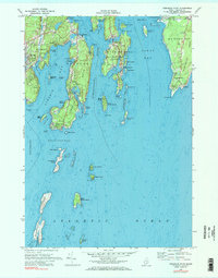
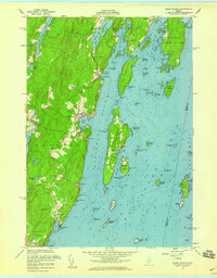
1969 Map of Pemaquid Point
USGS Topo · Published 1984About this map
The coastal jaggedness of Lincoln County is on full display where the Damariscotta River and Johns Bay meet the Atlantic Ocean. This 1960s maritime landscape is defined by its deep-water inlets and historical fishing villages like East Boothbay, South Bristol, and New Harbor. The map records a time of well-established coastal residency, showing the cluster of homes at Bayville and the seasonal orientation of Linekin and Ocean Point. Genealogists may find value in the location of Oaklawn Cem and several smaller Cem plots tucked away on Boothbay Neck. The presence of the Pemaquid Lighthouse at the tip of Pemaquid Point anchors the eastern side of the survey, while the western edge is marked by the elevations of Mt Pisgah and the working Gravel Pits near Boothbay Harbor.
Find a feature on this map
92 named features on this map. Tap any name to fly to it.
Don’t see what you’re looking for? This feature index may not catch every label — zoom into the map to look around manually.
Map Details
Editions of this 1969 Pemaquid Point Map
3 editions found
Other maps of this area

1893 · Boothbay
USGS Topo · 1:62,500

1904 · Monhegan
USGS Topo · 1:62,500

1906 · Monhegan
USGS Topo · 1:62,500

1941 · Boothbay
USGS Topo · 1:62,500

1943 · Boothbay
USGS Topo · 1:62,500

1944 · Boothbay
USGS Topo · 1:62,500

1948 · Bath
USGS Topo · 1:250,000
1955 · New Harbor
USGS Topo · 1:24,000
1955 · Louds Island
USGS Topo · 1:24,000

1956 · Bath
USGS Topo · 1:250,000