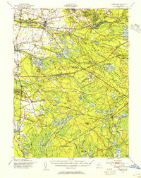
1949 Map of Pemberton
USGS Topo · Published 1954About this map
Fort Dix Military Reservation dominates the northern reaches of this map, showcasing an active military landscape with its Rifle Range and Impact area just before mid-century. This portion of Burlington County is defined by the transition from the bustling hub of Pemberton and its industrial North Branch Rancocas Creek corridor to the dense, marshy expanses of the Lebanon State Forest. Genealogists and historians can trace the network of small settlements and family-named landmarks like Sooy Place, Johnson Place, and Upton. The map also captures the critical rail infrastructure of the era, featuring the Pennsylvania and Central Railroad of New Jersey lines that connected these pine-rich regions. From the cranberry bogs of Whitesbog to the iron history at Hampton Furnace, the map preserves a landscape where the natural resource economy and military expansion coexist.
Find a feature on this map
96 named features on this map. Tap any name to fly to it.
Don’t see what you’re looking for? This feature index may not catch every label — zoom into the map to look around manually.
Map Details
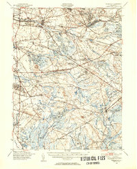
Editions of this 1949 Pemberton Map
2 editions found
Other maps of this area

1884 · Whitings
USGS Topo · 1:62,500

1888 · Bordentown
USGS Topo · 1:62,500

1888 · Pemberton
USGS Topo · 1:62,500

1888 · Little Egg Harbor
USGS Topo · 1:62,500

1888 · Mount Holly
USGS Topo · 1:62,500

1888 · Cassville
USGS Topo · 1:62,500

1888 · Whitings
USGS Topo · 1:62,500

1890 · Hammonton
USGS Topo · 1:62,500

1890 · Burlington
USGS Topo · 1:62,500

1890 · Mullica
USGS Topo · 1:62,500
Featured Places
- Southampton Township, NJ
- Plumsted Township, NJ
- Tabernacle Township, NJ
- Eastampton Township, NJ
- Springfield Township, NJ