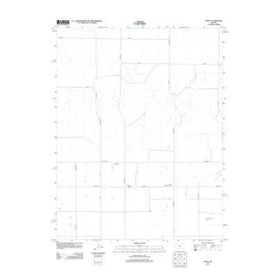
2012 Map of Pence
USGS Topo · Published 2012About this map
Pence is the central hub of this Scott County landscape, representing a quiet settlement where agricultural life and spiritual heritage intersect. This region of Kansas is defined by its rectilinear road grid, which follows section lines across the prairie. Local history is anchored at the Pence Cem and the Scott Mennonite Cem, providing valuable points of reference for genealogists. The road network utilizes distinctive animal and tribal names, including Dakota, Bison, and Coyote, alongside a series of north-south routes like N Beaver Rd, N Apache Rd, and N Cherokee Rd. These roads segment the terrain into broad agricultural tracts, showing how modern land management maintains the traditional township-and-range layout established over a century ago.
Find a feature on this map
17 named features on this map. Tap any name to fly to it.
Don’t see what you’re looking for? This feature index may not catch every label — zoom into the map to look around manually.
Map Details
Editions of this 2012 Pence Map
This is the sole edition of this map. No revisions or reprints were ever made.
Other maps of this area

1939 · Lake Mc Bride
USGS Topo · 1:24,000

1939 · Sandon
USGS Topo · 1:62,500

1939 · Pence
USGS Topo · 1:62,500

1941 · Pence
USGS Topo · 1:62,500

1942 · Sandon
USGS Topo · 1:62,500

1942 · Lake Mc Bride
USGS Topo · 1:31,680

1955 · Scott City
USGS Topo · 1:250,000

1958 · Scott City
USGS Topo · 1:250,000

1974 · Elkader SW
USGS Topo · 1:24,000
1974 · Lone Butte
USGS Topo · 1:24,000