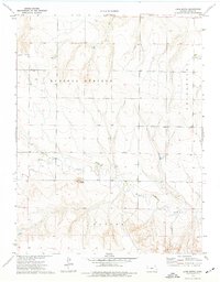
1974 Map of Lone Butte
USGS Topo · Published 1977About this map
Lone Butte stands as a prominent landmark in this portion of Logan County, surveyed in the mid-1970s. The landscape is defined by the drainages of Twin Butte Creek, which winds through the townships of Russell Springs, Logan, and Paxton. The map documents a period of resource extraction and local infrastructure, noted by a Quarry in the southern reaches and scattered industrial markers like a Drill Hole and Well. Evidence of the area's practical navigation is visible at several points where a Ford crosses the creek bed. A Radio Tower on the heights near Twin Butte indicates the technological layer of this rural environment, while the detailed contour lines illustrate the varied elevations and breaks typical of the Kansas high plains.
Find a feature on this map
11 named features on this map. Tap any name to fly to it.
Don’t see what you’re looking for? This feature index may not catch every label — zoom into the map to look around manually.
Map Details
Editions of this 1974 Lone Butte Map
This is the sole edition of this map. No revisions or reprints were ever made.
Other maps of this area

1939 · Pence
USGS Topo · 1:62,500

1941 · Pence
USGS Topo · 1:62,500

1955 · Scott City
USGS Topo · 1:250,000

1958 · Scott City
USGS Topo · 1:250,000

1968 · Russell Springs 3 NE
USGS Topo · 1:24,000

1969 · Russell Springs 2 NE
USGS Topo · 1:24,000

1969 · Russell Springs 2 SE
USGS Topo · 1:24,000

1972 · Russell Springs
USGS Topo · 1:24,000
1972 · Russell Springs NE
USGS Topo · 1:24,000
1974 · Russell Springs SE
USGS Topo · 1:24,000