
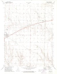
1972 Map of Russell Springs
USGS Topo · Published 1974About this map
Russell Springs serves as the central hub of this High Plains landscape, situated along the northern bank of the Smoky Hill River. The map traces a significant piece of frontier history with the Butterfield Overland Trail cutting east-to-west across the terrain, paralleling the river valley. This route, a vital stagecoach and freight line in the mid-19th century, is complemented by the presence of an Old Railroad Grade and several Historical Markers, emphasizing the area's role in early Western transportation. To the west, Logan County State Park encompasses the drainages of West Spring Creek and East Spring Creek, which flow south toward the main river channel. Local life and history are further documented through the Russell Springs Cem and the Russell Springs Historical Park, while the presence of scattered Gravel Pits and various wells indicates the local extractive and water management practices of the early 1970s.
Find a feature on this map
16 named features on this map. Tap any name to fly to it.
Don’t see what you’re looking for? This feature index may not catch every label — zoom into the map to look around manually.
Map Details
Editions of this 1972 Russell Springs Map
This is the sole edition of this map. No revisions or reprints were ever made.
Other maps of this area

1954 · Goodland
USGS Topo · 1:250,000

1955 · Scott City
USGS Topo · 1:250,000

1956 · Goodland
USGS Topo · 1:250,000

1957 · Goodland
USGS Topo · 1:250,000

1958 · Scott City
USGS Topo · 1:250,000

1969 · Mc Allaster SE
USGS Topo · 1:24,000

1969 · Russell Springs 2 NE
USGS Topo · 1:24,000

1969 · Russell Springs 2 SE
USGS Topo · 1:24,000

1972 · Monument
USGS Topo · 1:24,000
1972 · Winona
USGS Topo · 1:24,000