
1969 Map of Russell Springs 2 NE
USGS Topo · Published 1971About this map
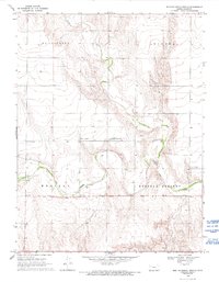
The Butterfield Overland Trail cuts a diagonal path across this Logan County landscape, following the natural corridor north of the Smoky Hill River. Surveyed in the late 1960s, the map illustrates the enduring legacy of 19th-century transit routes in Western Kansas, where modern property boundaries and section lines often align with these older tracks. Multiple Historical Markers are placed at key intervals along the trail, documenting its significance to the region's development. The river valley itself is defined by wide meanders and drainage features like the North Fork, while the upland areas show evidence of local industry through several Gravel Pits and a Quarry. Large land divisions including Mc Allaster, Winona, and Western Russell Springs establish the administrative and historical framework of this rural prairie terrain.
Find a feature on this map
10 named features on this map. Tap any name to fly to it.
Don’t see what you’re looking for? This feature index may not catch every label — zoom into the map to look around manually.
Map Details
Editions of this 1969 Russell Springs 2 NE Map
2 editions found
Other maps of this area

1954 · Goodland
USGS Topo · 1:250,000

1955 · Scott City
USGS Topo · 1:250,000

1956 · Goodland
USGS Topo · 1:250,000

1957 · Goodland
USGS Topo · 1:250,000

1958 · Scott City
USGS Topo · 1:250,000

1969 · Russell Springs 2 NW
USGS Topo · 1:24,000

1969 · Mc Allaster SE
USGS Topo · 1:24,000

1969 · Russell Springs 2 SW
USGS Topo · 1:24,000

1969 · Russell Springs 2 SE
USGS Topo · 1:24,000
1969 · Mc Allaster
USGS Topo · 1:24,000