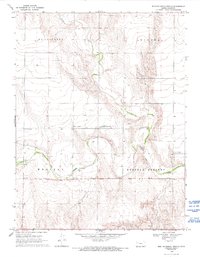
1969 Map of West of Russell Springs
USGS Topo · Published 1993About this map
The Butterfield Overland Trail cuts a historic path across this high plains landscape, following the general course of the North Fork Smoky Hill River. These mid-century surveys document the transition between the townships of Mc Allaster, Winona, Western, and Russell Springs, where the river’s winding path is the primary geological feature. Multiple Historical Markers are situated along the trail route, indicating its significance to the region's westward expansion history. The map also captures small-scale industrial activity such as a Gravel Pit and Quarry, while scattered Wells and a Well point to the critical need for groundwater management in this semi-arid part of Logan County.
Find a feature on this map
10 named features on this map. Tap any name to fly to it.
Don’t see what you’re looking for? This feature index may not catch every label — zoom into the map to look around manually.
Map Details
Editions of this 1969 West of Russell Springs Map
2 editions found
Other maps of this area

1954 · Goodland
USGS Topo · 1:250,000

1955 · Scott City
USGS Topo · 1:250,000

1956 · Goodland
USGS Topo · 1:250,000

1957 · Goodland
USGS Topo · 1:250,000

1958 · Scott City
USGS Topo · 1:250,000

1969 · Russell Springs 2 NW
USGS Topo · 1:24,000

1969 · Mc Allaster SE
USGS Topo · 1:24,000

1969 · Russell Springs 2 SW
USGS Topo · 1:24,000

1969 · Russell Springs 2 NE
USGS Topo · 1:24,000

1969 · Russell Springs 2 SE
USGS Topo · 1:24,000