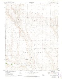
1972 Map of Russell Springs NE
USGS Topo · Published 1974About this map
Butterfield Overland Trail history defines this western Kansas landscape, following a path just north of the Smoky Hill River. This 1970s record shows the transit corridor where the overland route and an Old Railroad Grade parallel the river valley. The terrain is marked by significant erosion patterns, most notably Sixmile Gulch, which cuts across the central portion of the quadrangle. Aside from the primary natural features and transport routes, the area shows little development, preserved here as open range and agricultural land. A few localized landmarks like a Historical Marker and a Radio Tower serve as modern orientation points alongside older industrial sites such as a Gravel Pit.
Find a feature on this map
10 named features on this map. Tap any name to fly to it.
Don’t see what you’re looking for? This feature index may not catch every label — zoom into the map to look around manually.
Map Details
Editions of this 1972 Russell Springs NE Map
This is the sole edition of this map. No revisions or reprints were ever made.
Other maps of this area

1954 · Goodland
USGS Topo · 1:250,000

1955 · Scott City
USGS Topo · 1:250,000

1956 · Goodland
USGS Topo · 1:250,000

1957 · Goodland
USGS Topo · 1:250,000

1958 · Scott City
USGS Topo · 1:250,000

1972 · Russell Springs
USGS Topo · 1:24,000

1972 · Monument
USGS Topo · 1:24,000
1972 · Winona
USGS Topo · 1:24,000

1972 · Elkader NW
USGS Topo · 1:24,000

1974 · Elkader SW
USGS Topo · 1:24,000