
1968 Map of Russell Springs 3 NE
USGS Topo · Published 1970About this map
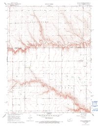
Chalk Creek carves a distinct east-west path through the high plains of western Kansas, defining the boundary between Logan and Wichita counties. The landscape of the late 1960s is marked by a scattered network of rural institutions that served this farming and ranching community, including the Beulah Cem and the High Plains Sch. A notable concentration of community life appears at the Church of the Nazarene, while the presence of a Quarry and numerous Wells suggests the local reliance on both the geological substrate and subterranean water resources. The inclusion of Hobson Airport illustrates the practical necessity of private aviation for transport and agricultural operations in these expansive townships, which are organized here under the historic names of Augustine, Paxton, Beaver, and Edwards.
Find a feature on this map
13 named features on this map. Tap any name to fly to it.
Don’t see what you’re looking for? This feature index may not catch every label — zoom into the map to look around manually.
Map Details
Editions of this 1968 Russell Springs 3 NE Map
2 editions found
Other maps of this area

1939 · Pence
USGS Topo · 1:62,500

1941 · Pence
USGS Topo · 1:62,500

1955 · Scott City
USGS Topo · 1:250,000

1958 · Scott City
USGS Topo · 1:250,000

1968 · Russell Springs 3 SW
USGS Topo · 1:24,000

1968 · Russell Springs 3 NW
USGS Topo · 1:24,000

1968 · Russell Springs 3 SE
USGS Topo · 1:24,000

1969 · Russell Springs 2 SW
USGS Topo · 1:24,000

1969 · Russell Springs 2 SE
USGS Topo · 1:24,000
1974 · Lone Butte
USGS Topo · 1:24,000