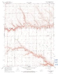
1968 Map of Beulah Cemetery
USGS Topo · Published 1993About this map
Chalk Creek carves a distinct horizontal path across this High Plains landscape, marking the boundary between Logan and Wichita Counties. The area is characterized by an extensive network of water wells, reflecting the importance of groundwater in this western Kansas terrain. The map reveals a community organized around family landmarks and essential local institutions, including the High Plains Sch and the Church of the Nazarene. Transportation and industry are noted by the presence of Hobson Airport and a Quarry located just north of the county line. The eponymous Beulah Cem sits centrally, providing a focal point for genealogical interest. Large land divisions such as Augustine, Edwards, Beaver, and Paxton define the regional geography during the late 1960s.
Find a feature on this map
12 named features on this map. Tap any name to fly to it.
Don’t see what you’re looking for? This feature index may not catch every label — zoom into the map to look around manually.
Map Details
Editions of this 1968 Beulah Cemetery Map
2 editions found
Other maps of this area

1939 · Pence
USGS Topo · 1:62,500

1941 · Pence
USGS Topo · 1:62,500

1955 · Scott City
USGS Topo · 1:250,000

1958 · Scott City
USGS Topo · 1:250,000

1968 · Russell Springs 3 SW
USGS Topo · 1:24,000

1968 · Russell Springs 3 NW
USGS Topo · 1:24,000

1968 · Russell Springs 3 SE
USGS Topo · 1:24,000

1968 · Russell Springs 3 NE
USGS Topo · 1:24,000

1969 · Russell Springs 2 SW
USGS Topo · 1:24,000

1969 · Russell Springs 2 SE
USGS Topo · 1:24,000