
1968 Map of Russell Springs 3 NW
USGS Topo · Published 1969About this map
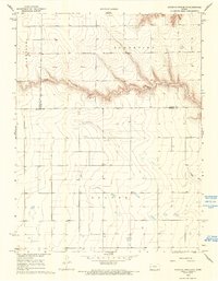
Chalk Creek winds through the northern portion of this High Plains landscape, cutting a distinct path across the townships of Harrison and Augustine. The terrain here is defined by an expansive grid of section lines and unimproved roads, reflecting the large-scale agricultural and ranching patterns of western Kansas in the late 1960s. The map reveals a reliance on groundwater for this upland region, with numerous scattered Well and Wells sites documented across the prairie south of the creek in Beaver. This 1968 survey captures the intersection of three counties, where the borders of Wallace, Logan, and Wichita meet, providing a clear record of the rural land divisions and the sparse, essential infrastructure of the era.
Find a feature on this map
9 named features on this map. Tap any name to fly to it.
Don’t see what you’re looking for? This feature index may not catch every label — zoom into the map to look around manually.
Map Details
Editions of this 1968 Russell Springs 3 NW Map
2 editions found
Other maps of this area

1955 · Scott City
USGS Topo · 1:250,000

1958 · Scott City
USGS Topo · 1:250,000

1959 · Wallace
USGS Topo · 1:62,500

1968 · Russell Springs 3 SW
USGS Topo · 1:24,000

1968 · Russell Springs 3 SE
USGS Topo · 1:24,000

1968 · Sharon Springs 4 NE
USGS Topo · 1:24,000

1968 · Russell Springs 3 NE
USGS Topo · 1:24,000

1969 · Russell Springs 2 SW
USGS Topo · 1:24,000

1969 · Russell Springs 2 SE
USGS Topo · 1:24,000

1970 · Sharon Springs 4 SE
USGS Topo · 1:24,000