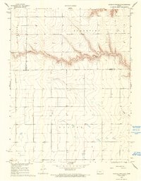
1968 Map of South of Twin Butte
USGS Topo · Published 1993About this map
Chalk Creek carves a distinctive horizontal path across this High Plains landscape, marking the transition between the rolling uplands of Harrison and Augustine to the north and the southern reaches of Beaver. The topography in this 1968 study is defined by sharp contour changes near the creek bed, contrasting with the expansive, grid-like division of the surrounding prairie. This area serves as a significant geographic meeting point, where the boundaries of Wallace, Logan, and Wichita counties converge. Scattered throughout the townships, numerous wells indicate the vital reliance on groundwater for sustaining the agricultural and ranching operations of western Kansas during this era. The map captures a moment when traditional land use patterns remained dominant, etched into a terrain shaped by the slow erosion of the creek through the chalky soil.
Find a feature on this map
8 named features on this map. Tap any name to fly to it.
Don’t see what you’re looking for? This feature index may not catch every label — zoom into the map to look around manually.
Map Details
Editions of this 1968 South of Twin Butte Map
2 editions found
Other maps of this area

1955 · Scott City
USGS Topo · 1:250,000

1958 · Scott City
USGS Topo · 1:250,000

1959 · Wallace
USGS Topo · 1:62,500

1968 · Russell Springs 3 SW
USGS Topo · 1:24,000

1968 · Russell Springs 3 NW
USGS Topo · 1:24,000

1968 · Russell Springs 3 SE
USGS Topo · 1:24,000

1968 · Sharon Springs 4 NE
USGS Topo · 1:24,000

1968 · Russell Springs 3 NE
USGS Topo · 1:24,000

1969 · Russell Springs 2 SW
USGS Topo · 1:24,000

1969 · Russell Springs 2 SE
USGS Topo · 1:24,000