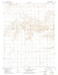
1976 Map of Pence
USGS Topo · Published 1978About this map
Pence stands as the primary settlement in this Western Kansas landscape, situated near the border of Logan Co Scott Co. This 1970s survey captures the region's agricultural and resource-driven character, where the township of Beaver meets the southern reaches of Paxton and Lees. The terrain is defined by the winding course of Chalk Creek and the notable incision of Timber Canyon to the east. Local community landmarks include the Pence Cem and Scott Ch, which serve the surrounding rural population. The economy of the era is evidenced by several Gravel Pit operations and a significant Pipeline corridor cutting across the southern sections, while numerous wells are scattered throughout the territory, marking the ongoing extraction and water management efforts in this part of Scott County.
Find a feature on this map
14 named features on this map. Tap any name to fly to it.
Don’t see what you’re looking for? This feature index may not catch every label — zoom into the map to look around manually.
Map Details
Editions of this 1976 Pence Map
This is the sole edition of this map. No revisions or reprints were ever made.
Other maps of this area

1939 · Lake Mc Bride
USGS Topo · 1:24,000

1939 · Sandon
USGS Topo · 1:62,500

1939 · Pence
USGS Topo · 1:62,500

1941 · Pence
USGS Topo · 1:62,500

1942 · Sandon
USGS Topo · 1:62,500

1942 · Lake Mc Bride
USGS Topo · 1:31,680

1955 · Scott City
USGS Topo · 1:250,000

1958 · Scott City
USGS Topo · 1:250,000

1974 · Elkader SW
USGS Topo · 1:24,000
1974 · Lone Butte
USGS Topo · 1:24,000