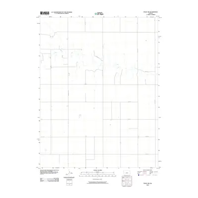
2009 Map of Pence SW
USGS Topo · Published 2009About this map
Ladder Creek winds through this section of Wichita County, defining the primary drainage pattern across a landscape otherwise shaped by the strict geometry of the Public Land Survey System. The map documents the rural infrastructure of Leoti Township during the early 21st century, where a grid of county roads supports the local agricultural economy. Key north-south corridors like Marienthal Rd and Co Rd 19 connect the area to nearby regional centers. The interplay between the natural meanders of the creek and the rigid section-line roads, such as Co Rd G and Co Rd L, reveals how land management and transportation have adapted to the High Plains topography. For those tracing land ownership or regional development, this survey records the footprint of farmsteads and the network of local routes like Co Rd 22 and Co Rd M.
Find a feature on this map
15 named features on this map. Tap any name to fly to it.
Don’t see what you’re looking for? This feature index may not catch every label — zoom into the map to look around manually.
Map Details
Editions of this 2009 Pence SW Map
This is the sole edition of this map. No revisions or reprints were ever made.
Other maps of this area

1939 · Pence
USGS Topo · 1:62,500

1941 · Modoc
USGS Topo · 1:62,500

1941 · Pence
USGS Topo · 1:62,500

1951 · Modoc
USGS Topo · 1:62,500

1955 · Scott City
USGS Topo · 1:250,000

1958 · Scott City
USGS Topo · 1:250,000

1968 · Russell Springs 3 SE
USGS Topo · 1:24,000

1968 · Russell Springs 3 NE
USGS Topo · 1:24,000

1970 · Leoti
USGS Topo · 1:24,000
1976 · Pence
USGS Topo · 1:24,000