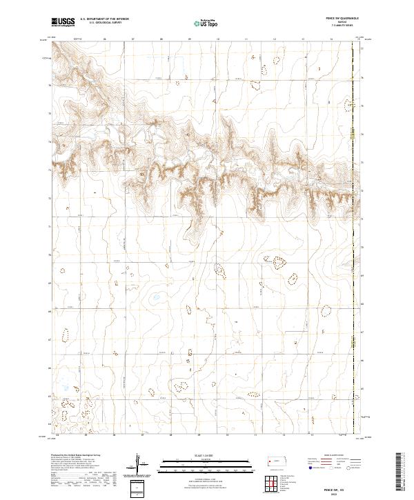
2022 Map of Pence SW
USGS Topo · Published 2022About this map
The Wichita Co Scott Co border defines the eastern edge of this landscape, where the High Plains terrain is etched by a complex network of ephemeral drainage patterns. This 2022 survey captures the modern agricultural grid of Western Kansas, dominated by a systematic layout of section-line roads such as Marienthal Rd and Co Rd G. The map reveals the relationship between the flat upland plains and the sudden breaks of local topography, where the land drops away into deeply textured draws and coulees. These natural features contrast sharply with the rigid human geometry of Co Rd N and other corridors that facilitate transport across the sparse, open country. For researchers, the map provides a precise look at the rural infrastructure and land management boundaries in this remote corner of the state.
Find a feature on this map
25 named features on this map. Tap any name to fly to it.
Don’t see what you’re looking for? This feature index may not catch every label — zoom into the map to look around manually.
Map Details
Editions of this 2022 Pence SW Map
This is the sole edition of this map. No revisions or reprints were ever made.
Other maps of this area

1939 · Pence
USGS Topo · 1:62,500

1941 · Modoc
USGS Topo · 1:62,500

1941 · Pence
USGS Topo · 1:62,500

1951 · Modoc
USGS Topo · 1:62,500

1955 · Scott City
USGS Topo · 1:250,000

1958 · Scott City
USGS Topo · 1:250,000

1968 · Russell Springs 3 SE
USGS Topo · 1:24,000

1968 · Russell Springs 3 NE
USGS Topo · 1:24,000

1970 · Leoti
USGS Topo · 1:24,000
1976 · Pence
USGS Topo · 1:24,000