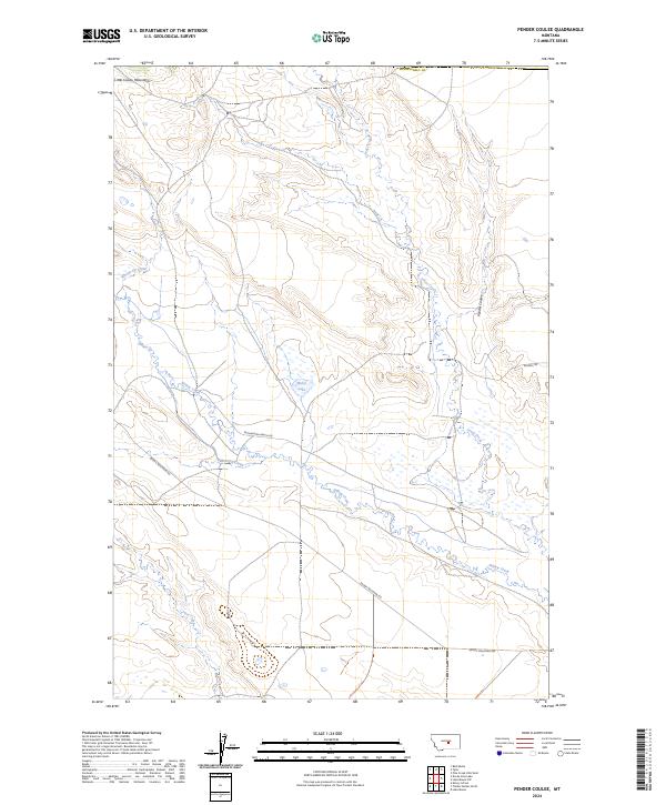
2024 Map of Pender Coulee
USGS Topo · Published 2024About this map
The Lake Mason National Wildlife Refuge dominates this central Montana landscape, where the southern foothills of the Little Snowy Mountains give way to a network of seasonal drainages and high plains. This contemporary survey details a remote section of Musselshell Co, centered on the alkaline waters of Miller Lake and the eponymous Pender Coulee. The map illustrates a high-desert drainage pattern where water is the primary architect of the land, featuring named sources like Big Spring and the meandering paths of Whoop-Up Creek, Jones Creek, and Willow Creek. Human activity is marked by isolated corridors such as Snowy Mountain Rd and Pronghorn Ranch Rd, reflecting the expansive ranching and conservation character of the region. This document serves as a precise guide to the modern boundaries of protected wetlands and the rugged topography of the Snowy Mountain front.
Find a feature on this map
19 named features on this map. Tap any name to fly to it.
Don’t see what you’re looking for? This feature index may not catch every label — zoom into the map to look around manually.
Map Details
Editions of this 2024 Pender Coulee Map
This is the sole edition of this map. No revisions or reprints were ever made.
Other maps of this area

1954 · Roundup
USGS Topo · 1:250,000

1958 · Roundup
USGS Topo · 1:250,000

1986 · Tyler
USGS Topo · 1:24,000

1986 · Devils Hole Lake
USGS Topo · 1:24,000

1986 · Pender Coulee
USGS Topo · 1:24,000

1986 · Pike Creek Hills West
USGS Topo · 1:24,000

1986 · Lake Mason NW
USGS Topo · 1:24,000

1986 · Emory School
USGS Topo · 1:24,000
1986 · Timber Buttes North
USGS Topo · 1:24,000
1986 · Bald Butte
USGS Topo · 1:24,000