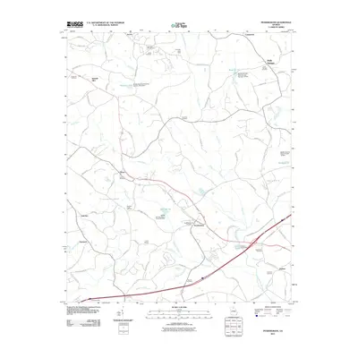
2011 Map of Pendergrass
USGS Topo · Published 2011About this map
Pendergrass and Talmo serve as the primary population hubs in this region of northern Georgia, situated amidst a landscape defined by the drainage systems of the Middle Oconee River and its tributaries. The terrain is notably marked by a series of man-made water features, including Reservoir Six, Reservoir Nine, and Reservoir 12, which reflect modern water management efforts. For local historians, the sheet is exceptionally detailed regarding community burial sites, from the Pendergrass City Cemetery and New Salem Cemetery to the Academy Cemetery near Holders.
Find a feature on this map
104 named features on this map. Tap any name to fly to it.
Don’t see what you’re looking for? This feature index may not catch every label — zoom into the map to look around manually.
Map Details
Editions of this 2011 Pendergrass Map
This is the sole edition of this map. No revisions or reprints were ever made.
Other maps of this area

1891 · Gainesville
USGS Topo · 1:125,000

1954 · Greenville
USGS Topo · 1:250,000

1958 · Greenville
USGS Topo · 1:250,000

1964 · Maysville
USGS Topo · 1:24,000

1964 · Chestnut Mountain
USGS Topo · 1:24,000
1964 · Winder North
USGS Topo · 1:24,000
1964 · Auburn
USGS Topo · 1:24,000

1964 · Gainesville
USGS Topo · 1:24,000

1964 · Pendergrass
USGS Topo · 1:24,000
1964 · Jefferson
USGS Topo · 1:24,000