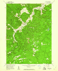
1959 Map of Penfield
USGS Topo · Published 1960About this map
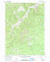
Moshannon State Forest dominates this landscape in the late 1950s, a rugged expanse where the industrial footprint of extractive industries meets large-scale conservation efforts. The Baltimore and Ohio Railroad follows the valley floor through Penfield, serving as the primary corridor for local commerce alongside Bennett Branch. This valley is a hub of activity, with numerous Strip Mines and quarries dotting the hillsides, signaling the region's heavy reliance on coal and stone production.
Find a feature on this map
55 named features on this map. Tap any name to fly to it.
Don’t see what you’re looking for? This feature index may not catch every label — zoom into the map to look around manually.
Map Details
Editions of this 1959 Penfield Map
5 editions found
Other maps of this area

1929 · Clearfield
USGS Topo · 1:48,000

1929 · Penfield
USGS Topo · 1:62,500

1932 · Clearfield
USGS Topo · 1:62,500

1932 · Penfield
USGS Topo · 1:62,500

1941 · Benezette
USGS Topo · 1:62,500

1941 · Ridgway
USGS Topo · 1:62,500

1943 · Benezette
USGS Topo · 1:62,500

1944 · Ridgway
USGS Topo · 1:62,500

1957 · Warren
USGS Topo · 1:250,000

1958 · Warren
USGS Topo · 1:250,000
Featured Places
- Pine Township, PA
- Gobbler Knob, Huston Township
- Fox Township, PA
- Penfield, Huston Township
- Anderson Creek, Pine Township