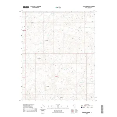
2018 Map of Penitentiary Mountain
USGS Topo · Published 2018About this map
Penitentiary Mtn dominates this portion of the Aquarius Mountains, where a network of springs and drainage washes defines the high desert environment. The landscape is characterized by its vital water sources, including Penitentiary Spring, Alkali Spring, and the multi-staged Middle Water Spring and Lower Water Spring. These features suggest a history of seasonal ranching and survival in an arid climate, further evidenced by man-made infrastructure like Ray Cowden Tank and Upper Bald Mountain Tank. The eastern boundary is marked by Cedar Basin, while Trout Cr and McGee Wash cross the southern reaches near Pony Mesa. Access is primarily limited to the primitive Fort Rock Rd, reflecting the isolation of this western Arizona range.
Find a feature on this map
31 named features on this map. Tap any name to fly to it.
Don’t see what you’re looking for? This feature index may not catch every label — zoom into the map to look around manually.
Map Details
Editions of this 2018 Penitentiary Mountain Map
This is the sole edition of this map. No revisions or reprints were ever made.
Other maps of this area

1886 · Diamond Creek
USGS Topo · 1:250,000

1892 · Diamond Creek
USGS Topo · 1:250,000

1923 · Signal
USGS Topo · 1:250,000

1942 · Signal
USGS Topo · 1:250,000

1948 · Williams
USGS Topo · 1:250,000

1950 · Prescott
USGS Topo · 1:250,000

1954 · Prescott
USGS Topo · 1:250,000

1954 · Williams
USGS Topo · 1:250,000

1956 · Williams
USGS Topo · 1:250,000

1958 · Prescott
USGS Topo · 1:250,000