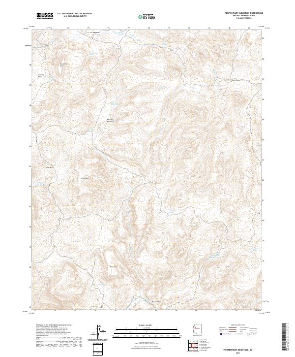
2021 Map of Penitentiary Mountain
USGS Topo · Published 2021About this map
Penitentiary Mtn and the surrounding high country of the Aquarius Mountains define this landscape in Mohave County. This modern topographic study reveals a complex network of seasonal water sources and livestock infrastructure essential to the region's ranching heritage. Vital water points such as Penitentiary Spring, Ray Cowden Tank, and Alkali Spring are scattered across the terrain, indicating the importance of water management in these arid basins. The map captures the distinct topography of Cornwall Basin and Cedar Basin, where drainage systems like Knight Cr and Trout Cr carve through the foothills. Other prominent landmarks include the high peaks of Snow Mtn and Farrel Mtn, alongside the flat-topped Pony Mesa, providing a comprehensive view of the geographic transitions within this part of the Arizona desert.
Find a feature on this map
30 named features on this map. Tap any name to fly to it.
Don’t see what you’re looking for? This feature index may not catch every label — zoom into the map to look around manually.
Map Details
Editions of this 2021 Penitentiary Mountain Map
This is the sole edition of this map. No revisions or reprints were ever made.
Other maps of this area

1886 · Diamond Creek
USGS Topo · 1:250,000

1892 · Diamond Creek
USGS Topo · 1:250,000

1923 · Signal
USGS Topo · 1:250,000

1942 · Signal
USGS Topo · 1:250,000

1948 · Williams
USGS Topo · 1:250,000

1950 · Prescott
USGS Topo · 1:250,000

1954 · Prescott
USGS Topo · 1:250,000

1954 · Williams
USGS Topo · 1:250,000

1956 · Williams
USGS Topo · 1:250,000

1958 · Prescott
USGS Topo · 1:250,000