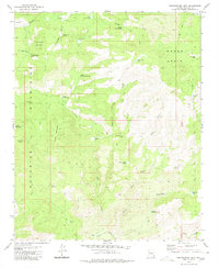
1980 Map of Penitentiary Mtn
USGS Topo · Published 1980About this map
The Aquarius Mountains and Cedar Basin define this landscape in Mohave County, where the terrain is marked by essential water sources and high peaks. Livestock and ranching infrastructure is evident throughout, from the Ruth Cowden Well and Ray Cowden Tank to the Paso Robles Well near the basin. These features, along with numerous named springs like Penitentiary Spring and Alkali Spring, trace the critical water network required to support life and industry in this arid environment.
Find a feature on this map
39 named features on this map. Tap any name to fly to it.
Don’t see what you’re looking for? This feature index may not catch every label — zoom into the map to look around manually.
Map Details
Editions of this 1980 Penitentiary Mtn Map
This is the sole edition of this map. No revisions or reprints were ever made.
Other maps of this area

1886 · Diamond Creek
USGS Topo · 1:250,000

1892 · Diamond Creek
USGS Topo · 1:250,000

1923 · Signal
USGS Topo · 1:250,000

1942 · Signal
USGS Topo · 1:250,000

1948 · Williams
USGS Topo · 1:250,000

1950 · Prescott
USGS Topo · 1:250,000

1954 · Prescott
USGS Topo · 1:250,000

1954 · Williams
USGS Topo · 1:250,000

1956 · Williams
USGS Topo · 1:250,000

1958 · Prescott
USGS Topo · 1:250,000