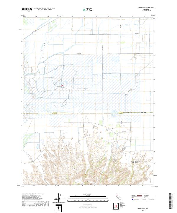
2021 Map of Pennington
USGS Topo · Published 2021About this map
Pennington serves as the central settlement on this map, located at the northern doorstep of the Sutter Buttes. The geography here transitions abruptly from the level floor of the Sacramento Valley to the dramatic volcanic rises of the buttes, which dominate the southern portion of the sheet. Between these features, Peace Valley provides a sheltered enclave in the foothills, while the northern reaches are defined by an extensive network of irrigation and drainage infrastructure. Water management is a primary theme of the landscape, evident in the Cherokee Canal, Main Drainage Canal, and various engineered waterways like the Belding Lateral. This modern survey records the persistence of local landmarks such as North Butte Cem and Pugh Cem, alongside the Cnps Hike Route Trl, highlighting the area's dual character as a productive agricultural zone and a site for natural exploration.
Find a feature on this map
39 named features on this map. Tap any name to fly to it.
Don’t see what you’re looking for? This feature index may not catch every label — zoom into the map to look around manually.
Map Details
Editions of this 2021 Pennington Map
This is the sole edition of this map. No revisions or reprints were ever made.
Other maps of this area

1888 · Marysville
USGS Topo · 1:125,000

1891 · Marysville
USGS Topo · 1:125,000

1894 · Marysville
USGS Topo · 1:125,000

1895 · Marysville
USGS Topo · 1:125,000

1911 · Sutter
USGS Topo · 1:31,680

1911 · Sanborn Slough
USGS Topo · 1:31,680

1911 · Landlow
USGS Topo · 1:31,680

1912 · Marysville Buttes
USGS Topo · 1:31,680

1912 · Butte City
USGS Topo · 1:31,680

1912 · Pennington
USGS Topo · 1:31,680