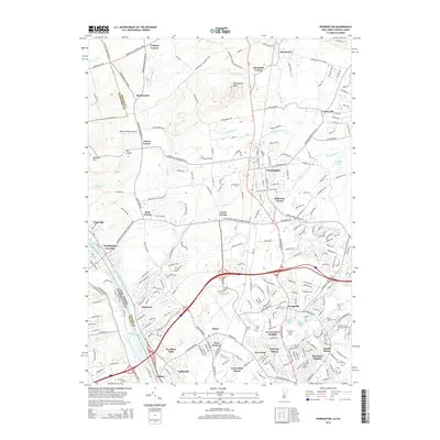
2014 Map of Pennington
USGS Topo · Published 2014About this map
The Delaware River corridor defines this portion of Mercer County, where the historic Washington Crossing and Scudders Falls mark significant transit points across the water. The landscape is characterized by a series of prominent elevations, including Baldpate Mtn, Mt Canoe, and Pennington Mtn, which overlook a network of smaller communities such as Harbourton and Bear Tavern. To the south, the suburban expansion of Ewingville and West Trenton is evident, centered around institutions like The Coll of New Jersey and an extensive collection of local cemeteries including Saint Hedwigs Cem and Ewing Cem. The Delaware and Raritan Canal runs parallel to the river, tracing the early industrial infrastructure that once dominated the valley's transport. Modern infrastructure, including the CSX rail line and Interstate 95, highlights the area's continued importance as a regional crossroads near the Pennsylvania border.
Find a feature on this map
99 named features on this map. Tap any name to fly to it.
Don’t see what you’re looking for? This feature index may not catch every label — zoom into the map to look around manually.
Map Details
Editions of this 2014 Pennington Map
This is the sole edition of this map. No revisions or reprints were ever made.
Other maps of this area

1888 · Bordentown
USGS Topo · 1:62,500

1888 · Princeton
USGS Topo · 1:62,500

1890 · Lambertville
USGS Topo · 1:62,500

1890 · Burlington
USGS Topo · 1:62,500

1891 · Lambertville
USGS Topo · 1:62,500

1893 · Bordentown
USGS Topo · 1:62,500

1893 · Burlington
USGS Topo · 1:62,500

1894 · Princeton
USGS Topo · 1:62,500

1894 · Lambertville
USGS Topo · 1:62,500

1904 · Burlington
USGS Topo · 1:62,500
Featured Places
- Ewing Township, NJ
- Lawrence Township, NJ
- Lower Makefield Township, PA
- Hopewell Township, NJ
- Upper Makefield Township, PA