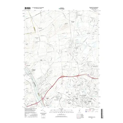
2016 Map of Pennington
USGS Topo · Published 2016About this map
The Delaware River and the parallel Delaware and Raritan Canal form a historic transportation corridor along the western edge of this Mercer County landscape. In the north, the terrain rises toward Pennington Mtn and Baldpate Mtn, overlooking a series of longstanding settlements like Harbourton and Marshalls Corner. The central borough of Pennington serves as a hub for the surrounding township, connected by traditional routes such as the Pennington Titusville Rd.
Find a feature on this map
265 named features on this map. Tap any name to fly to it.
Don’t see what you’re looking for? This feature index may not catch every label — zoom into the map to look around manually.
Map Details
Editions of this 2016 Pennington Map
This is the sole edition of this map. No revisions or reprints were ever made.
Other maps of this area

1888 · Bordentown
USGS Topo · 1:62,500

1888 · Princeton
USGS Topo · 1:62,500

1890 · Lambertville
USGS Topo · 1:62,500

1890 · Burlington
USGS Topo · 1:62,500

1891 · Lambertville
USGS Topo · 1:62,500

1893 · Bordentown
USGS Topo · 1:62,500

1893 · Burlington
USGS Topo · 1:62,500

1894 · Princeton
USGS Topo · 1:62,500

1894 · Lambertville
USGS Topo · 1:62,500

1904 · Burlington
USGS Topo · 1:62,500
Featured Places
- Ewing Township, NJ
- Lawrence Township, NJ
- Lower Makefield Township, PA
- Hopewell Township, NJ
- Upper Makefield Township, PA