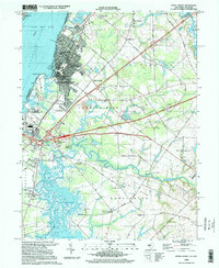
1995 Map of Penns Grove
USGS Topo · Published 1999About this map
The Delaware River forms a wide industrial and natural border in this mid-1990s survey, anchoring the development of Penns Grove and the residential clusters of Carneys Point. Inland, the landscape transitions from the suburban grid of South Penns Grove and Glenside to the expansive wetlands of Pine Island Meadow and Kates Creek Meadow. This era shows a community defined by its proximity to both water and major transit, with the New Jersey Turnpike cutting across the terrain near established landmarks like Salem Comm College. Local history is preserved in names like Biddles Landing and Courses Landing along the Salem River, while small rural outposts such as Marshalltown and Slapes Corner dot the southeastern quadrant. The presence of Friendship Station and the Conrail lines reflects the area's long-standing reliance on rail infrastructure for the movement of goods and people.
Find a feature on this map
73 named features on this map. Tap any name to fly to it.
Don’t see what you’re looking for? This feature index may not catch every label — zoom into the map to look around manually.
Map Details
Editions of this 1995 Penns Grove Map
This is the sole edition of this map. No revisions or reprints were ever made.
Other maps of this area

1890 · Salem
USGS Topo · 1:62,500

1894 · Chester
USGS Topo · 1:62,500

1896 · Chester
USGS Topo · 1:62,500

1898 · Salem
USGS Topo · 1:62,500

1898 · Chester
USGS Topo · 1:62,500

1901 · Camden
USGS Topo · 1:125,000

1901 · West Chester
USGS Topo · 1:62,500

1904 · West Chester
USGS Topo · 1:62,500

1904 · Wilmington
USGS Topo · 1:62,500

1906 · Wilmington
USGS Topo · 1:62,500