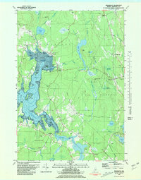
1981 Map of Penobscot
USGS Topo · Published 1981About this map
Northern Bay and the tidal reaches of the Bagaduce River dominate this coastal Maine landscape, where the irregular shoreline of Penobscot and South Penobscot meets a series of complex coves and inlets. The map reveals a community defined by its proximity to the water, from the clusters of small islands like Aunt Mollie Island and Youngs Islands to the numerous landings at Grindle Point and Hutchins Point. Inland, the terrain is characterized by high ridges such as Hinckley Ridge and Grey Ridge, punctuated by distinct elevations like Wallamatogus Mtn and Patton Hill. Genealogists will find a high concentration of family-named burial grounds, including Leach Cem, Bridges Cem, and Westcott Cem, scattered across the rural landscape. This edition captures the transition from the marine-focused economies of the lower Bagaduce to the upland bogs and ponds like Wight Pond and Turtle Pond near North Blue Hill.
Find a feature on this map
90 named features on this map. Tap any name to fly to it.
Don’t see what you’re looking for? This feature index may not catch every label — zoom into the map to look around manually.
Map Details
Editions of this 1981 Penobscot Map
2 editions found
Other maps of this area

1900 · Orland
USGS Topo · 1:62,500

1900 · Bucksport
USGS Topo · 1:62,500

1902 · Bucksport
USGS Topo · 1:62,500

1902 · Castine
USGS Topo · 1:62,500

1904 · Castine
USGS Topo · 1:62,500

1904 · Bluehill
USGS Topo · 1:62,500

1905 · Penobscot Bay
USGS Topo · 1:125,000

1941 · Castine
USGS Topo · 1:62,500

1942 · Orland
USGS Topo · 1:62,500

1942 · Bucksport
USGS Topo · 1:62,500