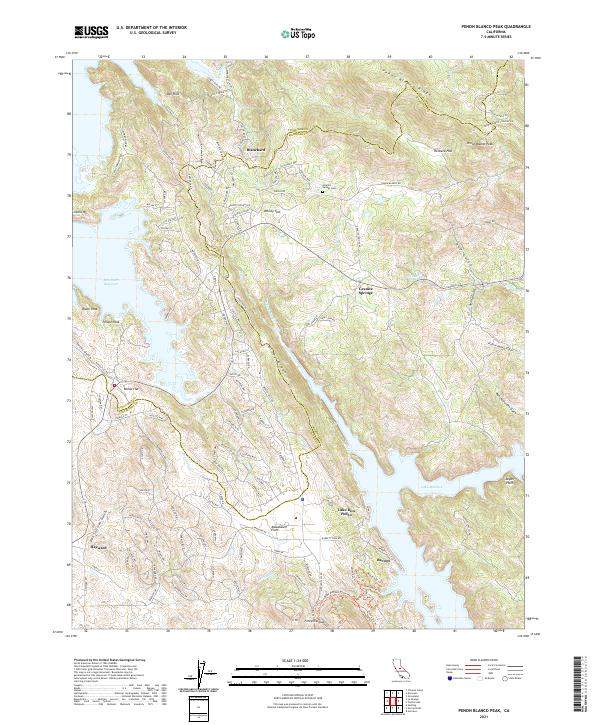
2021 Map of Penon Blanco Peak
USGS Topo · Published 2021About this map
The Tuolumne and Mariposa County line divides this landscape of steep ridges and reservoir shorelines. Small settlements like Blanchard and Granite Springs anchor a network of rural roads, including Black Jack Mine Rd and Solano Mine Rd, which point to the region's mining heritage. The topography is dominated by the Penon Blanco Ridge and the Oat Hills, falling away toward the massive water bodies of Don Pedro Reservoir and Lake McClure.
Find a feature on this map
138 named features on this map. Tap any name to fly to it.
Don’t see what you’re looking for? This feature index may not catch every label — zoom into the map to look around manually.
Map Details
Editions of this 2021 Penon Blanco Peak Map
This is the sole edition of this map. No revisions or reprints were ever made.
Other maps of this area

1893 · Sonora
USGS Topo · 1:125,000

1896 · Sonora
USGS Topo · 1:125,000

1897 · Sonora
USGS Topo · 1:125,000

1898 · Sonora
USGS Topo · 1:125,000

1915 · La Grange
USGS Topo · 1:24,000

1916 · Merced Falls
USGS Topo · 1:24,000
1918 · Snelling
USGS Topo · 1:31,680

1919 · La Grange
USGS Topo · 1:31,680

1919 · Merced Falls
USGS Topo · 1:31,680

1944 · Merced Falls
USGS Topo · 1:62,500