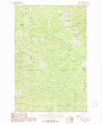
1988 Map of Penrose Peak
USGS Topo · Published 1988About this map
Lolo National Forest dominates this mountain landscape along the border of Sanders and Mineral counties in the late 1980s. The topography is defined by the prominent C C Divide, which serves as a major hydrologic boundary separating the drainage basins of Cherry Creek and Twelvemile Creek. High elevation landmarks such as Penrose Peak and Cherry Peak tower over a network of seasonal streams, including Blackburn Creek and Flat Rock Creek.
Find a feature on this map
26 named features on this map. Tap any name to fly to it.
Don’t see what you’re looking for? This feature index may not catch every label — zoom into the map to look around manually.
Map Details
Editions of this 1988 Penrose Peak Map
This is the sole edition of this map. No revisions or reprints were ever made.
Other maps of this area

1918 · St Regis
USGS Topo · 1:125,000

1919 · St. Regis
USGS Topo · 1:125,000

1937 · Thompson Falls
USGS Topo · 1:125,000

1937 · Thompson Falls
USGS Topo · 1:62,500

1956 · St Regis
USGS Topo · 1:62,500

1956 · Wallace
USGS Topo · 1:250,000

1957 · Thompson Falls
USGS Topo · 1:62,500

1957 · Haugan
USGS Topo · 1:62,500

1960 · Wallace
USGS Topo · 1:250,000

1964 · Eddy Mountain
USGS Topo · 1:24,000