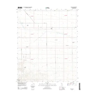
2015 Map of Pentland
USGS Topo · Published 2015About this map
Pentland and San Emidio occupy a landscape where the flat expanses of the Central Valley meet the rising foothills of the San Emidio Mountains. This 2015 topography reveals the critical infrastructure of the region, dominated by the sweeping curve of the Governor Edmund G Brown California Aqueduct as it traverses Midway Valley and Maricopa Flat. The map documents a complex network of industrial and agricultural access roads, such as Western Minerals Rd, Metson Lease, and Rancho Emidio, which speak to the area's long history of mineral extraction and ranching.
Find a feature on this map
33 named features on this map. Tap any name to fly to it.
Don’t see what you’re looking for? This feature index may not catch every label — zoom into the map to look around manually.
Map Details
Editions of this 2015 Pentland Map
This is the sole edition of this map. No revisions or reprints were ever made.
Other maps of this area

1903 · Mt. Pinos
USGS Topo · 1:125,000

1910 · Buena Vista Lake
USGS Topo · 1:125,000

1912 · Buena Vista Lake
USGS Topo · 1:125,000

1929 · Mouth of Kern
USGS Topo · 1:31,680

1930 · Millux
USGS Topo · 1:31,680

1931 · Pentland Junction
USGS Topo · 1:31,680

1931 · Hayes Ranch
USGS Topo · 1:31,680

1932 · Mouth of Kern
USGS Topo · 1:31,680

1933 · Hayes Ranch
USGS Topo · 1:31,680
1933 · Millux
USGS Topo · 1:31,680