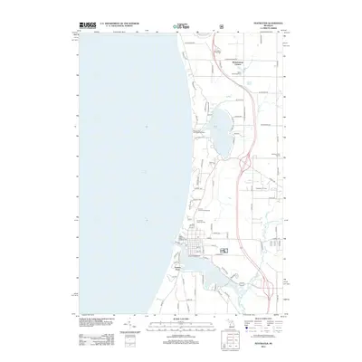
2012 Map of Pentwater
USGS Topo · Published 2012About this map
Pentwater Lake and the coastal inlet of the N Br Pentwater River define the local topography of this Lake Michigan shoreline community. The village is anchored by the Po and Snug Harbor Marina, while the surrounding landscape reflects a high density of recreational infrastructure, including the Mears State Park Campground and Whispering Surf Camping Resort. To the south, the settlement of French Town sits near the mouth of the channel, while the northern extent reaches Meisenheimer Corners. Economic and community markers are found in the Pentwater Oil Field to the east and the Pentwater Township Cem near the town center. The map captures a transition where inland waterways like Bass Lake and creeks such as Kibby Cr meet the dunes of the big lake.
Find a feature on this map
85 named features on this map. Tap any name to fly to it.
Don’t see what you’re looking for? This feature index may not catch every label — zoom into the map to look around manually.
Map Details
Editions of this 2012 Pentwater Map
This is the sole edition of this map. No revisions or reprints were ever made.
Other maps of this area

1931 · Hart NW
USGS Topo · 1:31,680

1931 · Hart NE
USGS Topo · 1:31,680

1932 · Ludington NE
USGS Topo · 1:31,680

1932 · Ludington SW
USGS Topo · 1:31,680

1932 · Ludington SE
USGS Topo · 1:31,680

1932 · Ludington
USGS Topo · 1:31,680

1954 · Milwaukee
USGS Topo · 1:250,000

1958 · Milwaukee
USGS Topo · 1:250,000

1959 · Ludington
USGS Topo · 1:62,500

1959 · Hart
USGS Topo · 1:62,500