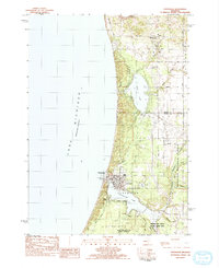
1983 Map of Pentwater
USGS Topo · Published 1983About this map
Pentwater Lake and the narrow channel connecting it to Lake Michigan form the central focus of this coastal Michigan landscape. The village of Pentwater sits on this strategic waterfront, supported by a network of local institutions like St Vincents and the Township Cemetery. To the north, Bass Lake is surrounded by signs of resource extraction, including Salt Well and Chapped Well sites, indicating the area's industrial history beyond its modern role as a recreation hub.
Find a feature on this map
40 named features on this map. Tap any name to fly to it.
Don’t see what you’re looking for? This feature index may not catch every label — zoom into the map to look around manually.
Map Details
Editions of this 1983 Pentwater Map
This is the sole edition of this map. No revisions or reprints were ever made.
Other maps of this area

1931 · Hart NW
USGS Topo · 1:31,680

1931 · Hart NE
USGS Topo · 1:31,680

1932 · Ludington NE
USGS Topo · 1:31,680

1932 · Ludington SW
USGS Topo · 1:31,680

1932 · Ludington SE
USGS Topo · 1:31,680

1932 · Ludington
USGS Topo · 1:31,680

1954 · Milwaukee
USGS Topo · 1:250,000

1958 · Milwaukee
USGS Topo · 1:250,000

1959 · Ludington
USGS Topo · 1:62,500

1959 · Hart
USGS Topo · 1:62,500