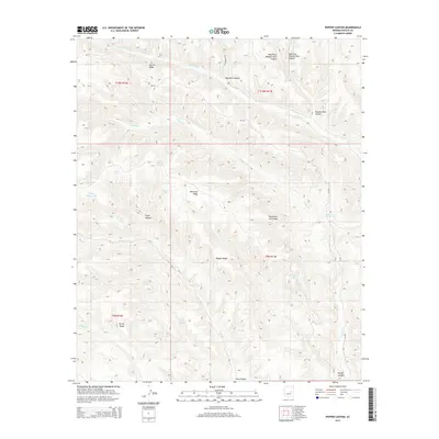
2014 Map of Pepper Canyon
USGS Topo · Published 2014About this map
Wagon Wheel Lake and Pepper Lake are part of a high-altitude water system located within the White Mountain Apache territory of eastern Arizona. The terrain is defined by a series of parallel northwest-to-southeast trending features, including Whitetail Ridge and Telephone Line Ridge, which separate the various canyon systems of Cibecue Cr and Carrizo Cr. The presence of numerous named water sources like White Spring and Twin Springs suggests a landscape where water management was critical for ranching or local subsistence. Infrastructure is sparse, characterized primarily by the Bia-34 roadway and the W Buckskin Trl, reflecting the area's remote character and focus on land preservation and natural resource navigation.
Find a feature on this map
34 named features on this map. Tap any name to fly to it.
Don’t see what you’re looking for? This feature index may not catch every label — zoom into the map to look around manually.
Map Details
Editions of this 2014 Pepper Canyon Map
This is the sole edition of this map. No revisions or reprints were ever made.
Other maps of this area

1886 · Holbrook
USGS Topo · 1:250,000

1893 · Holbrook
USGS Topo · 1:250,000

1954 · Holbrook
USGS Topo · 1:250,000

1957 · Holbrook
USGS Topo · 1:250,000

1958 · Holbrook
USGS Topo · 1:250,000

1960 · Holbrook
USGS Topo · 1:250,000

1961 · Clay Springs
USGS Topo · 1:62,500

1961 · Heber
USGS Topo · 1:62,500

1961 · Cibecue
USGS Topo · 1:62,500

1961 · Chediski Peak
USGS Topo · 1:62,500