
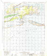
1944 Map of Perdido Bay South
USGS Topo · Published 1944About this map
Perdido Beach and the shoreline of Perdido Bay define this wartime coastal survey, which captures the boundary between Florida and Alabama during the mid-1940s. The landscape is dominated by the intricate network of tidal waters and barrier islands, including the long stretch of the Old River and Big Lagoon south of the mainland. A specialized infrastructure is visible to support maritime navigation, featuring the Intracoastal Waterway and a notable Pontoon Swing Bridge connecting the coastal segments.
Find a feature on this map
43 named features on this map. Tap any name to fly to it.
Don’t see what you’re looking for? This feature index may not catch every label — zoom into the map to look around manually.
Map Details
Editions of this 1944 Perdido Bay South Map
This is the sole edition of this map. No revisions or reprints were ever made.
Other maps of this area

1921 · Bon Secour
USGS Topo · 1:62,500

1921 · Fort Barrancas
USGS Topo · 1:62,500

1941 · Fort Barrancas
USGS Topo · 1:62,500

1941 · Foley
USGS Topo · 1:62,500

1943 · Fort Barrancas
USGS Topo · 1:62,500

1943 · Foley
USGS Topo · 1:62,500

1944 · Perdido Bay North
USGS Topo · 1:25,000

1944 · Miflin
USGS Topo · 1:25,000

1944 · West Pensacola
USGS Topo · 1:25,000
1944 · Fort Barrancas
USGS Topo · 1:25,000
Featured Places
- Perdido Beach, AL
- Chanticleer, FL
- Gulf Beach Heights, FL
- Perdido Bay Country Club Estates, FL
- Treasure Hill Park, FL