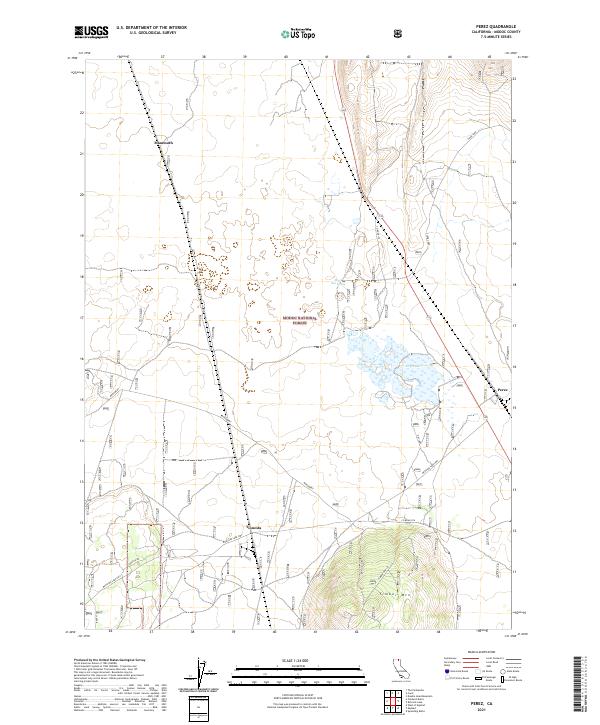
2021 Map of Perez
USGS Topo · Published 2021About this map
Tionesta and Perez anchor the eastern and southern edges of this high-country landscape, where the volcanic topography of the Modoc National Forest meets an complex network of transportation and water management. The terrain is dominated by the prominent elevation of Timber Mountain, topped by the Timber Mtn Lo lookout station. This area reflects a landscape shaped by both natural features and human infrastructure, evidenced by the large expanse of Dry Lake and the intermittent waters of Clear Lake. Roads like the Medicine Lake Hwy and Co Road 97A navigate through the township grids of T45N and T44N, connecting isolated settlements and springs such as Negro Ben Spring. The map documents a sparsely populated but critical corridor of northern California, where forestry and seasonal water levels define the local geography.
Find a feature on this map
18 named features on this map. Tap any name to fly to it.
Don’t see what you’re looking for? This feature index may not catch every label — zoom into the map to look around manually.
Map Details
Editions of this 2021 Perez Map
This is the sole edition of this map. No revisions or reprints were ever made.
Other maps of this area

1886 · Modoc Lava Bed
USGS Topo · 1:250,000

1892 · Modoc Lava-Bed
USGS Topo · 1:250,000

1951 · Clear Lake Reservoir
USGS Topo · 1:62,500

1951 · Tulelake
USGS Topo · 1:62,500

1952 · Timber Mountain
USGS Topo · 1:62,500

1952 · Hackamore
USGS Topo · 1:62,500

1954 · Alturas
USGS Topo · 1:250,000

1958 · Alturas
USGS Topo · 1:250,000

1962 · Alturas
USGS Topo · 1:250,000

1965 · Alturas
USGS Topo · 1:250,000