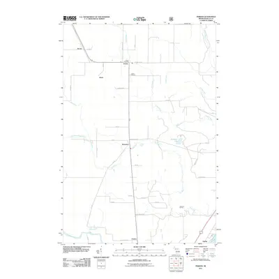
2011 Map of Perkins
USGS Topo · Published 2011About this map
The Tacoosh River and Days River drainage systems define this landscape in Delta County, where small settlements and rural homesteads are connected by a grid of numbered roads. The village of Perkins serves as a local hub, featuring the Perkins Post Office and the nearby Perkins Cemetery. Moving south, the community of Brampton sits near the confluence where the West Branch Days River meets the main stem, just west of Brampton Lake. The map reveals a transition from these agricultural and timbered upland areas toward the southern coastal influence of the Escanaba River. Other legacy locales such as Winde, Beaver, and Chaison are documented alongside recreation sites like the Gladstone Ski Park, reflecting the region's blend of rural industry and seasonal outdoor activity.
Find a feature on this map
42 named features on this map. Tap any name to fly to it.
Don’t see what you’re looking for? This feature index may not catch every label — zoom into the map to look around manually.
Map Details
Editions of this 2011 Perkins Map
This is the sole edition of this map. No revisions or reprints were ever made.
Other maps of this area

1932 · Gladstone NE
USGS Topo · 1:31,680

1932 · Rock SW
USGS Topo · 1:31,680

1932 · Trenary SW
USGS Topo · 1:31,680

1932 · Gladstone SE
USGS Topo · 1:31,680

1932 · Rapid River NW
USGS Topo · 1:31,680

1932 · Rock SE
USGS Topo · 1:31,680

1932 · Rapid River SW
USGS Topo · 1:31,680

1932 · Gladstone SW
USGS Topo · 1:31,680

1932 · Gladstone NW
USGS Topo · 1:31,680

1950 · Gladstone NW
USGS Topo · 1:31,680