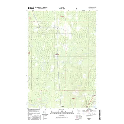
2017 Map of Perkins
USGS Topo · Published 2017About this map
Brampton and Perkins anchor this northern Michigan landscape, where the Tacoosh River and Days River systems weave through the lowlands of Delta County. The settlement pattern follows the established corridors of Old State Hwy 35 and the railway, connecting smaller locales like Winde, Beaver, and Chaison. To the south, the map reaches the industrial and maritime fringes of Kipling at the edge of Little Bay de Noc.
Find a feature on this map
46 named features on this map. Tap any name to fly to it.
Don’t see what you’re looking for? This feature index may not catch every label — zoom into the map to look around manually.
Map Details
Editions of this 2017 Perkins Map
This is the sole edition of this map. No revisions or reprints were ever made.
Other maps of this area

1932 · Gladstone NE
USGS Topo · 1:31,680

1932 · Rock SW
USGS Topo · 1:31,680

1932 · Trenary SW
USGS Topo · 1:31,680

1932 · Gladstone SE
USGS Topo · 1:31,680

1932 · Rapid River NW
USGS Topo · 1:31,680

1932 · Rock SE
USGS Topo · 1:31,680

1932 · Rapid River SW
USGS Topo · 1:31,680

1932 · Gladstone SW
USGS Topo · 1:31,680

1932 · Gladstone NW
USGS Topo · 1:31,680

1950 · Gladstone NW
USGS Topo · 1:31,680