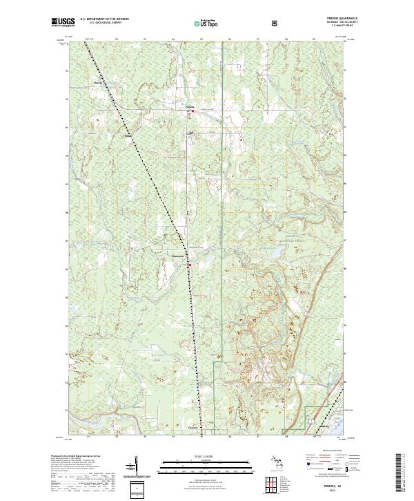
2023 Map of Perkins
USGS Topo · Published 2023About this map
The Tacoosh River and Days River drainage systems define this section of Delta County, where small settlements like Perkins and Brampton line the corridor of Old State Hwy 35. The landscape is heavily influenced by the presence of the Hiawatha National Forest, which covers much of the eastern and central terrain. Genealogical interest is centered on the Perkins Cem and the clusters of small, rural hamlets such as Beaver, Winde, and Chaison that have long served as local centers for this timber-rich region. To the southeast, the terrain reaches the shoreline of Little Bay de Noc at Kipling. The map details the transition from forested tracts to the more developed coastal and riverside areas, including the recreational Days River Pathway winding through the southern woods.
Find a feature on this map
46 named features on this map. Tap any name to fly to it.
Don’t see what you’re looking for? This feature index may not catch every label — zoom into the map to look around manually.
Map Details
Editions of this 2023 Perkins Map
This is the sole edition of this map. No revisions or reprints were ever made.
Other maps of this area

1932 · Gladstone NE
USGS Topo · 1:31,680

1932 · Rock SW
USGS Topo · 1:31,680

1932 · Trenary SW
USGS Topo · 1:31,680

1932 · Gladstone SE
USGS Topo · 1:31,680

1932 · Rapid River NW
USGS Topo · 1:31,680

1932 · Rock SE
USGS Topo · 1:31,680

1932 · Rapid River SW
USGS Topo · 1:31,680

1932 · Gladstone SW
USGS Topo · 1:31,680

1932 · Gladstone NW
USGS Topo · 1:31,680

1950 · Gladstone NW
USGS Topo · 1:31,680