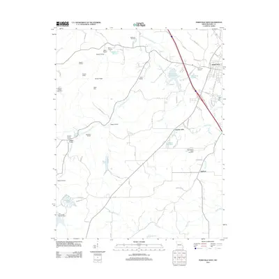
2012 Map of Perryville West
USGS Topo · Published 2012About this map
The western outskirts of Perryville serve as a transition from the developing residential and commercial corridors along Cinque Hommes Dr to the rolling agricultural and wooded terrain of Perry County. The landscape is defined by its water resources, ranging from the meandering Apple Creek and South Fork Saline Creek to numerous managed reservoirs such as Perry County Community Lake, Saint Marys Lake, and the residential Colonial Acres Lake. Genealogists and local historians can trace the placement of Mount Hope Cemetery and Saint Rose of Lima Cemetery relative to established rural communities like Friendly Valley and Highland. The map reveals a high density of named ridges and hollows, including Barbier Ridge, Pecaut Ridge, and Kuhlman Hollow, which dictate the winding paths of rural routes like PCR 816 and PCR 600. Evidence of local engineering appears in the series of named dams, such as Eddleman Lake Dam and Hickory Hollow Lake Dam, supporting water management in this limestone-influenced region.
Find a feature on this map
87 named features on this map. Tap any name to fly to it.
Don’t see what you’re looking for? This feature index may not catch every label — zoom into the map to look around manually.
Map Details
Editions of this 2012 Perryville West Map
This is the sole edition of this map. No revisions or reprints were ever made.
Other maps of this area

1907 · Weingarten
USGS Topo · 1:62,500

1909 · Weingarten
USGS Topo · 1:62,500

1910 · Higdon
USGS Topo · 1:62,500

1915 · Chester
USGS Topo · 1:62,500

1923 · Perryville
USGS Topo · 1:62,500

1924 · Perryville
USGS Topo · 1:62,500

1947 · Chester
USGS Topo · 1:62,500

1949 · Paducah
USGS Topo · 1:250,000

1949 · Rolla
USGS Topo · 1:250,000

1950 · Paducah
USGS Topo · 1:250,000