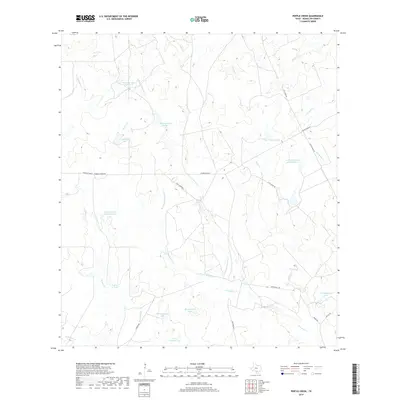
2019 Map of Pertle Creek
USGS Topo · Published 2019About this map
The watershed of Pertle Creek and the Leoncita Creek drainage system define this portion of McMullen County, where rangeland management and water preservation are central to the landscape. Numerous named reservoirs, including Beckman Lake Number 1, Beckman Lake Number 2, and James Donnell Lake Number 2, indicate the historical importance of surface water storage for cattle ranching in the South Texas brush country. These water bodies often bear the names of local ranching families, such as A R Kuykendall Lake and L L Graham Lake. The network of private roads like Franklin Ranch Rd and the aptly named High Lonesome track reveal the sparse settlement pattern and the vast scale of individual landholdings in this region. This survey captures a moment in the modern ranching era where traditional land use continues along seasonal waterways like N Prong Leoncita Cr and W Prong Leoncita Cr.
Find a feature on this map
32 named features on this map. Tap any name to fly to it.
Don’t see what you’re looking for? This feature index may not catch every label — zoom into the map to look around manually.
Map Details
Editions of this 2019 Pertle Creek Map
This is the sole edition of this map. No revisions or reprints were ever made.
Other maps of this area

1925 · Tilden No. 1
USGS Topo · 1:48,000

1930 · Tilden
USGS Topo · 1:62,500

1942 · Fowlerton
USGS Topo · 1:62,500

1942 · Tilden
USGS Topo · 1:62,500

1953 · Crystal City
USGS Topo · 1:250,000

1955 · Crystal City
USGS Topo · 1:250,000

1956 · Hindes
USGS Topo · 1:62,500

1956 · Franklin Settlement
USGS Topo · 1:62,500

1956 · Fowlerton
USGS Topo · 1:62,500

1961 · Crystal City
USGS Topo · 1:250,000