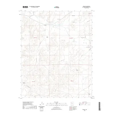
2020 Map of Pescado
USGS Topo · Published 2020About this map
Pescado and its surrounding ranchlands sit at the heart of this landscape, where the Rio Pescado cuts through the high desert of McKinley County. The settlement pattern here is closely tied to water and terrain, visible in the cluster of Lower Pescado and Upper Pescado near the Pescado Spring and Pescado Reservoir. These vital water sources support the community within the broader Ramah Valley. The map details a network of tribal infrastructure, including Indian SVC Rte 12 and Indian SVC Rte 49, which navigate the complex topography of Pescado Canyon and Knife Hill Canyon. Notable landmarks like Beacon Light Hill and Antenna Hill provide distinct navigational points across the high mesas, while Jacks Lake serves as a secondary catchment in the southern portion of the quadrangle.
Find a feature on this map
29 named features on this map. Tap any name to fly to it.
Don’t see what you’re looking for? This feature index may not catch every label — zoom into the map to look around manually.
Map Details
Editions of this 2020 Pescado Map
This is the sole edition of this map. No revisions or reprints were ever made.
Other maps of this area

1886 · Wingate
USGS Topo · 1:250,000

1892 · Wingate
USGS Topo · 1:250,000

1954 · Saint Johns
USGS Topo · 1:250,000

1954 · Gallup
USGS Topo · 1:250,000

1957 · Saint Johns
USGS Topo · 1:250,000

1958 · Gallup
USGS Topo · 1:250,000

1958 · Saint Johns
USGS Topo · 1:250,000

1959 · Gallup
USGS Topo · 1:250,000

1962 · Gallup
USGS Topo · 1:250,000

1962 · Saint Johns
USGS Topo · 1:250,000