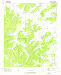
1972 Map of Pescado
USGS Topo · Published 1976About this map
Pescado and its surrounding canyonlands appear in this 1972 field-checked survey, revealing a landscape defined by traditional land use and water management within the Zuni Indian Reservation. The village site is anchored by the Rio Pescado, where the Pescado Reservoir and Pescado Spring served as vital water sources for this arid region. Numerous Ruins are documented across the terrain, particularly near the river and Pescado Draw, indicating deep historical occupation.
Find a feature on this map
25 named features on this map. Tap any name to fly to it.
Don’t see what you’re looking for? This feature index may not catch every label — zoom into the map to look around manually.
Map Details
Editions of this 1972 Pescado Map
This is the sole edition of this map. No revisions or reprints were ever made.
Other maps of this area

1886 · Wingate
USGS Topo · 1:250,000

1892 · Wingate
USGS Topo · 1:250,000

1954 · Saint Johns
USGS Topo · 1:250,000

1954 · Gallup
USGS Topo · 1:250,000

1957 · Saint Johns
USGS Topo · 1:250,000

1958 · Gallup
USGS Topo · 1:250,000

1958 · Saint Johns
USGS Topo · 1:250,000

1959 · Gallup
USGS Topo · 1:250,000

1962 · Gallup
USGS Topo · 1:250,000

1962 · Saint Johns
USGS Topo · 1:250,000