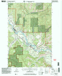
2003 Map of Peshastin
USGS Topo · Published 2006About this map
The Wenatchee River flows through a landscape defined by sharp elevation changes and agricultural utility at the start of the 21st century. The settlements of Peshastin and Dryden serve as the primary hubs, connected by the historical Sunset Highway. The map reveals a valley tightly managed for transit and industry, evidenced by the presence of a Siphon, a Gaging Sta, and the Substa near the riverbanks.
Find a feature on this map
47 named features on this map. Tap any name to fly to it.
Don’t see what you’re looking for? This feature index may not catch every label — zoom into the map to look around manually.
Map Details
Editions of this 2003 Peshastin Map
This is the sole edition of this map. No revisions or reprints were ever made.
Other maps of this area

1897 · Mount Stuart
USGS Topo · 1:125,000

1901 · Chelan
USGS Topo · 1:125,000

1901 · Chiwaukum
USGS Topo · 1:125,000

1902 · Mount Stuart
USGS Topo · 1:125,000

1904 · Chiwaukum
USGS Topo · 1:125,000

1913 · Wenatchee
USGS Topo · 1:62,500

1915 · Wenatchee
USGS Topo · 1:62,500

1920 · Colockum Pass
USGS Topo · 1:125,000

1922 · Colockum Pass
USGS Topo · 1:125,000

1957 · Wenatchee
USGS Topo · 1:250,000