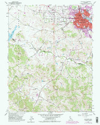
1953 Map of Petaluma
USGS Topo · Published 1981About this map
Petaluma serves as the focal point of this mid-century survey, showing the transition from the concentrated urban core along the Petaluma River to the expansive ranching and dairy lands of southern Sonoma and northern Marin counties. The cityscape is bounded by the Northwestern Pacific railroad, with established educational and civic institutions like McKinley Sch, McNear Sch, and the Fairgrounds marking the community's growth. North of the city, Cypress Hill Cemetery and St Vincents Sch stand as notable landmarks.
Find a feature on this map
45 named features on this map. Tap any name to fly to it.
Don’t see what you’re looking for? This feature index may not catch every label — zoom into the map to look around manually.
Map Details
Editions of this 1953 Petaluma Map
3 editions found
Other maps of this area

1914 · Petaluma
USGS Topo · 1:62,500

1916 · Santa Rosa
USGS Topo · 1:62,500

1916 · Point Reyes
USGS Topo · 1:48,000

1918 · Point Reyes
USGS Topo · 1:62,500

1935 · Sebastopol
USGS Topo · 1:48,000

1942 · Sebastopol
USGS Topo · 1:62,500

1942 · Petaluma
USGS Topo · 1:62,500

1944 · Santa Rosa
USGS Topo · 1:62,500

1947 · Santa Rosa
USGS Topo · 1:250,000

1949 · Santa Rosa
USGS Topo · 1:250,000