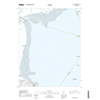
2018 Map of Petaluma Point
USGS Topo · Published 2018About this map
San Pablo Bay dominates this coastal landscape, where the waters meet the shorelines of Sonoma, Marin, and Contra Costa counties. The northern reaches are characterized by the marshy expanse of Tubbs Island and the prominent Midshipman Point, marking the mouth of the tidal waterways. To the west, the settlement of Black Point sits near the crossing of Novato Creek, adjacent to Day Island and Petaluma Point.
Find a feature on this map
35 named features on this map. Tap any name to fly to it.
Don’t see what you’re looking for? This feature index may not catch every label — zoom into the map to look around manually.
Map Details
Editions of this 2018 Petaluma Point Map
This is the sole edition of this map. No revisions or reprints were ever made.
Other maps of this area

1895 · San Francisco
USGS Topo · 1:62,500

1897 · Tamalpais
USGS Topo · 1:62,500

1899 · San Francisco
USGS Topo · 1:62,500

1902 · Napa
USGS Topo · 1:125,000

1914 · Petaluma
USGS Topo · 1:62,500

1915 · San Francisco
USGS Topo · 1:62,500

1916 · Mare Island
USGS Topo · 1:62,500

1941 · Tamalpais
USGS Topo · 1:62,500

1942 · Mare Island
USGS Topo · 1:62,500

1942 · Petaluma
USGS Topo · 1:62,500