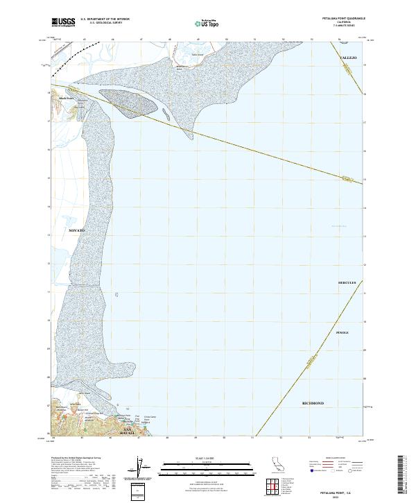
2022 Map of Petaluma Point
USGS Topo · Published 2022About this map
San Pablo Bay dominates this coastal landscape, where the waters meet the complex marshlands and shoreline points of Marin County. Near the northwestern edge, Black Point and Petaluma Point mark the transition toward the inland waterways, while Tubbs Island and Midshipman Point sit across the marshy reaches to the north. The southern shoreline is particularly detailed, revealing landforms such as China Camp Point, Buckeye Point, and Weber Point, alongside recreation-ready terrain like Miwok Meadows and Back Ranch Meadows.
Find a feature on this map
38 named features on this map. Tap any name to fly to it.
Don’t see what you’re looking for? This feature index may not catch every label — zoom into the map to look around manually.
Map Details
Editions of this 2022 Petaluma Point Map
This is the sole edition of this map. No revisions or reprints were ever made.
Other maps of this area

1895 · San Francisco
USGS Topo · 1:62,500

1897 · Tamalpais
USGS Topo · 1:62,500

1899 · San Francisco
USGS Topo · 1:62,500

1902 · Napa
USGS Topo · 1:125,000

1914 · Petaluma
USGS Topo · 1:62,500

1915 · San Francisco
USGS Topo · 1:62,500

1916 · Mare Island
USGS Topo · 1:62,500

1941 · Tamalpais
USGS Topo · 1:62,500

1942 · Mare Island
USGS Topo · 1:62,500

1942 · Petaluma
USGS Topo · 1:62,500