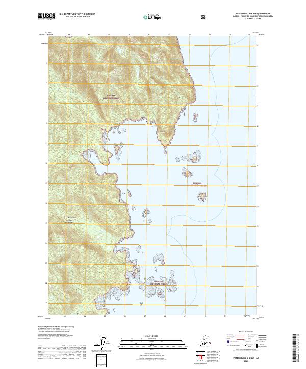
2021 Map of Petersburg A-6 NW
USGS Topo · Published 2021About this map
Kuiu Island dominates this portion of the Alexander Archipelago, where the land meets the sea at the prominent Point Amelius. This modern survey reveals a landscape almost entirely contained within the Tongass National Forest, showcasing a rugged coastline defined by protected waters like Louise Cove. The map documents the intricate relationship between the coastal shelf and the interior heights, where numerous small islands, including Amelius Island, dot the shoreline. The absence of roads or established settlements underscores the primitive nature of this maritime wilderness, providing a clear record of the area's physical geography and nautical access points as they exist in the early twenty-first century.
Find a feature on this map
10 named features on this map. Tap any name to fly to it.
Don’t see what you’re looking for? This feature index may not catch every label — zoom into the map to look around manually.
Map Details
Editions of this 2021 Petersburg A-6 NW Map
This is the sole edition of this map. No revisions or reprints were ever made.
Other maps of this area

1948 · Petersburg A-6
USGS Topo · 1:63,360

1948 · Port Alexander A-1
USGS Topo · 1:63,360

1948 · Petersburg B-6
USGS Topo · 1:63,360

1948 · Port Alexander B-1
USGS Topo · 1:63,360

1951 · Port Alexander
USGS Topo · 1:250,000

1951 · Petersburg B-6
USGS Topo · 1:63,360

1951 · Petersburg A-6
USGS Topo · 1:63,360

1952 · Petersburg
USGS Topo · 1:250,000

1952 · Port Alexander
USGS Topo · 1:250,000
1953 · Port Alexander B-1
USGS Topo · 1:63,360